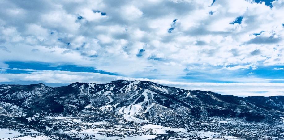
Nordic Skiing & Snowshoeing
There’s much more to winter in Steamboat than skiing. Enjoy the great outdoors by venturing out on the many snowshoe and cross country ski trails across Routt County.
EMERALD MOUNTAIN QUARRY
4 MILES ROUNDTRIP – MODERATE DIFFICULTY
Drive west out of town on U.S. 40 until 13th St. Turn left onto 13th, drive over bridge and make left onto Gilpin St. Make first left onto Saratoga Ave., and make a quick right onto Routt Street. Trailhead is at the top of Routt Street.
FISH CREEK FALLS
7.6 MILES ROUNDTRIP – MODERATE DIFFICULTY
From downtown Steamboat Springs, head east on third street for one block. Take a right onto Fish Creek Falls Rd., 3 miles to the Fish Creek Falls parking area. Two parking lots are provided. The lower lot is for overnight and horse trailers and the upper lot is for day hiking and picnic parking. Both lots require a $5 fee per vehicle per day. Please use the envelopes that are provided.
HOWELSEN HILL SKI AREA
DISTANCE & DIFFICULTY VARY
From downtown Steamboat Springs, head west on fifth street and make a right onto Howelsen Parkway. Take this to the parking area in front of the ski area. Hours and prices vary.
LAKE CATAMOUNT SKI TOURING CENTER
DISTANCE & DIFFICULTY VARY
Drive east out of Steamboat Springs on Hwy 40 to 131 South. Turn left onto County Road 18. Ski Touring Center on your left hand side. Please call 970-871-6667 for more information.
STEAMBOAT LAKE STATE PARK TOURING CENTER
DISTANCES VARY & MODERATE DIFFICULTY
Drive west out of Steamboat Springs on Hwy. 40 approximately 2 miles and turn right on Elk River Road (County Road 129). Follow CR 129 about 24 miles to Steamboat Lake. Visitor Center with trail maps and information will be on your left hand side. Please call 970-879-3922 for more information.
STEAMBOAT SKI TOURING CENTER
DISTANCE & DIFFICULTY VARY
Take Mount Werner Road off of Hwy. 40 to Steamboat Boulevard. Head west on Steamboat Boulevard to the Ski Touring Center on right. Call 970-879-8180 or visit nordicski.net for more information. Skiers only.
URANIUM MINE AT FISH CREEK FALLS
DISTANCES VARY & MODERATE DIFFICULTY
From downtown Steamboat Springs, head east on third street for one block. Take a right onto Fish Creek Falls Rd., 3 miles to the Fish Creek Falls parking area. Park at the upper lot and walk towards the lower lot. Trailhead begins just before the lower lot, on right hand side. Trailhead is not clearly marked.
1A WEST SUMMIT LOOP A
3.7 MILES ROUNDTRIP & MODERATE DIFFICULTY (RABBIT EARS)
Travel east of Steamboat Springs on U.S. 40 approximately 13 miles to the West Summit parking area on Rabbit Ears Pass. Route Description: Begin on the north side of the road. Skiing the route in a clockwise direction is less difficult, with gentler climbs and steeper descents through open and wooded areas. Views of the Yampa Valley and the Flat Tops are spectacular. The West Summit loops and surrounding terrain are the most popular skiing areas on the Hahns Peak/Bears Ears Ranger District.
1B WEST SUMMIT LOOP B
4 MILES ROUNDTRIP & EXPERT DIFFICULTY (RABBIT EARS)
This route is reached by skiing counter-clockwise on 1A. Ski past the first junction with 1B and climb to the top of the ridge. At the second junction, on the ridge top, ski 1B to the east. Route Description: This route is best skied in a clockwise direction. The route has several steep ascents and descents through heavy timber and open parks.
1C WEST SUMMIT LOOP C
3.7 MILES ROUNDTRIP & EXPERT DIFFICULTY (RABBIT EARS)
Travel east of Steamboat Springs on U.S. 40 approximately 13 miles. This route begins at the West Summit parking area. Park on the south side of the highway. Route description: Travel counter-clockwise for the best downhill runs. The route begins by following an old road. Woods, open meadows and some steep descents are encountered. This route connects with route 3Bmidway around the loop. Past this junction, the route follows the telephone lines and old highway, paralleling U.S. 40. The final portion follows the meadow edge back to the West Summit, then retraces the first segment of old road back to the parking area.
1D BRUCE’S TRAIL
3.1 MILES ROUNDTRIP & MODERATE DIFFICULTY (RABBIT EARS)
Travel east of Steamboat Springs on U.S. 40 approximately 14 miles to the parking area on the north side of the highway. A short spur connects the parking lot to the main trail. Route description: Designated wide to accommodate both skating and traditional skiing techniques. The trail is machine-groomed in the early ski season. The upper loop provides easy skiing, while the lower loop has a moderate difficulty rating.
2A HOGAN PARK ROUTE
7 MILES ROUNDTRIP & EXPERT DIFFICULTY (RABBIT EARS)
Travel east of Steamboat Springs on U.S. 40 approximately 18 miles to the Walton Peak parking area. The trail is one-way, ending at the base of Morningside Lift. Route description: recommended for experts only. If you plan to descent Mount Werner through the Steamboat Ski area, safety straps are required. Carry emergency/survival gear. If lift is not operating, climb 1 mile to top of lift, then descent 3 miles to ski area base.
2B FOX CURVE LOOP
3 MILES ROUNDTRIP & MODERATE DIFFICULTY (RABBIT EARS)
Travel approximately 17 miles east of Steamboat Springs on U.S. 40 to the Fox Curve parking area on Rabbit Ears Pass. Parking area is on the north side of the highway. Route description: This route has varied terrain including steep ascents and descents, timber, open meadows, flat stretches and rolling hills. Use caution when crossing Walton Creek.
WALTON CREEK LOOP
1.6 MILES ROUNDTRIP & HARD DIFFICULTY (RABBIT EARS)
Travel east of Steamboat Springs on U.S. 40 approximately 18 miles to the Walton Creek parking area on Rabbit Ears Pass. The parking area is on the south side of the highway. Route Description: Begin at the knoll south of the parking lot and follow the power line a short distance to the west. Turn south across Walton Creek and through Walton Creek Campground. The junction of the route 3B is reached in the meadow south of the campground. Past this junction, the route makes a steep ascent over a ridge and down an open slope to Walton Creek and the junction of route 3C. Follow Walton Creek back to the parking area.
3B PAR-A-LLEL ROUTE
2 MILES ROUNDTRIP & EXPERT DIFFICULTY (RABBIT EARS)
This route can be accessed from route 1C, beginning at the West Summit parking area on the south side of the highway, or from route 3A, beginning at the Walton Creek parking area. Route description: This route connects routes 1C and 3A. Skiing it west to east provides more exciting downhill runs; skiing east to west involves more climbing. Starting at the junction of 1C and 3B (west end), the route goes up a gentle slope and drops into a stream valley. Use caution when crossing streams and beaver ponds as they may be only partially frozen.
3C NORTH WALTON PEAK ROUTE
3 MILES ROUNDTRIP & MODERATE DIFFICULTY (RABBIT EARS)
Travel east of Steamboat Springs on U.S. 40 approximately 18 miles to the Walton Creek parking area. Route Description: This is the most popular route for telemarking. Begin at the knoll to the south side of the parking area and head southeast and downhill through the trees following route 3A. Approximately ½ mile from the parking area is the junction of 3A and 3C. The route crosses Walton Creek and travels through wooded areas and open meadows. It connects to the Forest Road 302 and follows it to the top of North Walton Peak. Opportunities for steep runs exist on the slopes of this peak.
INFO COURTESY OF STEAMBOATCHAMBER.COM
Quick Links
Find A Property
Copyright © 2026 Steamboat Lodging Company. All Rights Reserved. Web Design by InterCoastal Net Designs